Land Surveying Takes Centre Stage in Sierra Leone’s Land Reform
For many citizens, land is far more than a piece of property. It is a home, a farm, a family inheritance, a business investment or an asset on which future livelihoods depend.
A misplaced boundary can threaten ownership. An inaccurate survey plan can complicate a transaction, while a disputed parcel can trigger prolonged conflicts within families and communities.
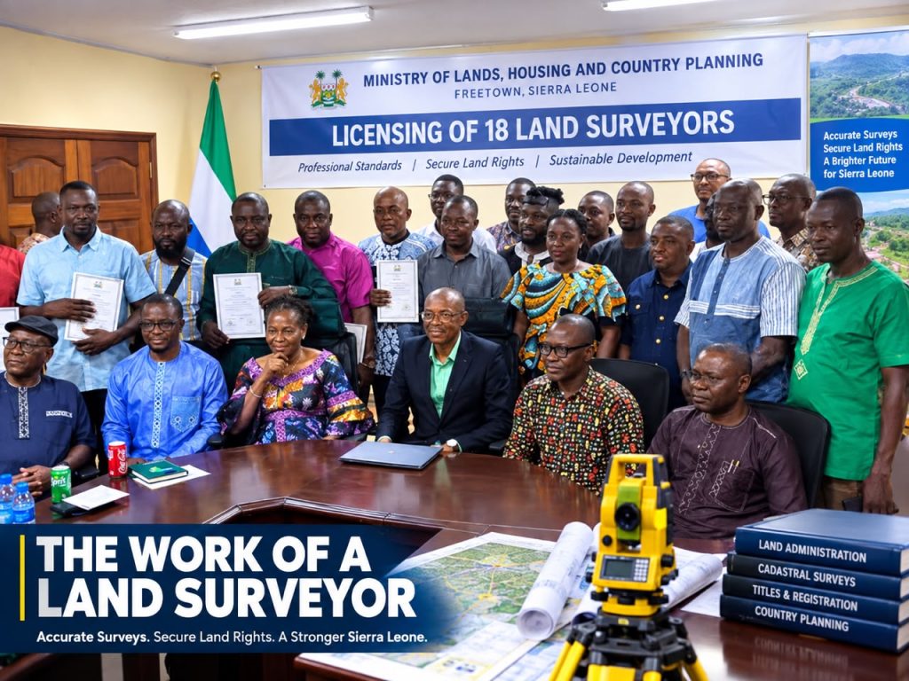
This explains why the licensing of 18 land surveyors in Freetown on 11 September carries significance beyond the surveying profession. The newly licensed practitioners are entering a system in which technical decisions can have far-reaching legal, economic and social consequences.
The licensing ceremony, held at the Conference Hall of the Ministry of Lands, Housing and Country Planning, brought together key officials responsible for shaping Sierra Leone’s land administration and reform agenda.
The event was chaired by the Permanent Secretary and attended by the Minister of Lands, Housing and Country Planning, Dr Turad Senesie; Deputy Minister Mrs Phylis Kormoh; Acting Professional Head and Director of Surveys and Lands, Tamba Sahr Dauda; Commissioner General of the National Land Commission, Abu Bakarr Sappay Foray-Musa; and the Chairman of Licensed Surveyors.
In his address, Mr Dauda emphasised the professional values expected of surveyors, including accuracy, integrity, fairness, proper record-keeping and independence from improper influence.
The message was clear: the certificate confirms qualification, but the quality and integrity of the work that follows will determine its real value to society.

The Directorate’s Pivotal Role
The Directorate of Surveys and Lands occupies a central position in Sierra Leone’s land administration system.
It is responsible for supervising licensed surveyors, approving survey plans, developing the national coordinate system, demarcating boundaries and maintaining land records, while also supporting comprehensive land title registration.
Such responsibilities demand more than administrative competence. They require technical expertise, consistency, professional discipline and an appreciation of the point at which technical decisions intersect with land rights and institutional reform.
Under the leadership of Mr Dauda, the Directorate has increasingly focused on modernising procedures, strengthening technical practice and moving surveying towards a more efficient and digitally enabled service.
His approach has placed greater emphasis on professional standards and the use of technology as part of the broader transformation of land administration.
The Directorate’s mandate has therefore become increasingly important as the Government pursues reforms designed to make land administration more transparent, secure and efficient.
Minister’s Vote of Confidence
The professional authority of the Director of Surveys and Lands has also received a notable public endorsement from Minister Dr Turad Senesie, who has described Mr Dauda as his “boss” when it comes to surveying.
The statement does not represent a formal alteration of the Ministry’s administrative hierarchy. Rather, it highlights the importance of specialised technical expertise within government.
By making the remark publicly, the Minister acknowledged the authority that Mr Dauda’s professional knowledge and judgement carry in the specialised field of surveying.
That confidence is particularly significant at a time when Sierra Leone’s land reforms increasingly require technical expertise capable of translating policy into accurate and reliable practice.

Law, Rights and the Surveyor
The importance of surveying becomes even clearer when considered alongside Sierra Leone’s recent land legislation.
The National Land Commission Act 2022 provides a framework for land administration, registration and mechanisms for addressing land title disputes.
The Customary Land Rights Act 2022, meanwhile, addresses access to customary land, non-discrimination, gender equality, joint and family ownership, as well as the certification and registration of land rights.
These laws establish rights, responsibilities and institutional structures. Surveying provides the spatial evidence necessary to connect those rights to specific parcels of land.
In practical terms, it is the surveyor who helps translate a legal description into a defined location on the ground.
This makes surveying a critical bridge between land policy and the realities faced by landowners, families, communities, investors and public institutions.
Technology Transforming the Profession
The technical environment in which surveyors operate is also changing rapidly.
Through the Sierra Leone Land Administration Project, the Ministry is strengthening land administration, land information systems and technical capacity, including the development of the Continuous Operating Reference Stations network and training on advanced surveying equipment.
The importance of the CORS network lies in its ability to support more precise positioning, thereby improving the spatial information required for cadastral surveying and land administration.
But technology alone cannot guarantee reliable land records.
Modern equipment must be matched by competent professionals who understand how to use it correctly, interpret the information it produces and maintain accurate records.
The real value of technological investment therefore lies in how effectively it improves professional practice and the reliability of land information.

Digital Land Administration
Digitalisation is also extending into the administrative side of land management.
The Ministry’s online platform supports land registration, surveying, country planning and lease management, including electronic submissions, payments and application tracking.
Such systems have the potential to make applications easier to trace, review and monitor while reducing dependence on informal administrative processes.
However, technology cannot replace professional judgement.
An online platform can record a survey submission, but it cannot determine whether a boundary was correctly identified in the field. It can process an application, but it cannot correct an inaccurate measurement or an unjustified boundary.
For that reason, administrative digitalisation must continue to be supported by strong professional standards.
Surveying and Systematic Land Registration
The role of surveyors becomes even more important as Sierra Leone moves towards systematic land registration.
The Sierra Leone Land Administration Project identifies systematic registration as a means of providing greater legal certainty, reducing land disputes, improving investment and supporting access to credit.
Recent study visits to Ghana and Kenya have also examined digital land administration, cadastral modernisation and the integration of surveying with land registration.
The underlying principle is straightforward: a land title cannot accurately describe a parcel unless that parcel has first been properly identified and measured.
Surveying is therefore close to the foundation of the registration system that Sierra Leone is seeking to establish.
Protecting Customary Land Rights
The stakes are particularly high under customary land tenure.
For many families and communities, a parcel of land represents a livelihood, an inheritance or a recognised interest passed from one generation to another.
The protections established under the Customary Land Rights Act consequently depend, in part, on records that accurately connect people and communities to specific pieces of land.
Professional independence is therefore not simply an abstract principle.
Surveyors must be prepared to resist improper pressure, disclose conflicts of interest, maintain proper records and correct deficiencies rather than allow convenience or influence to determine professional outcomes.
In land administration, professional restraint can mean the difference between a record that withstands scrutiny and a dispute that continues for years.

Surveying and National Planning
The importance of accurate surveying extends beyond individual land ownership.
Parliament passed the National Country Planning Act 2025 to strengthen national planning, sustainable development, infrastructure, housing, public amenities, public participation and development control.
All of these objectives depend on reliable information about land parcels, boundaries and existing interests.
As Sierra Leone’s towns and cities expand, survey information will influence decisions about roads, infrastructure, housing, public facilities, development control and competing land claims.
The quality of surveying will therefore increasingly form part of the quality of national planning itself.
A New Professional Responsibility
The 18 newly licensed surveyors now enter practice at an important stage in the country’s land reform process.
They will be expected to master electronic procedures, competently use modern positioning technology, submit complete and consistent information, maintain defensible records and respond professionally when their work is questioned.
The Sierra Leone Land Administration Project identifies institutional and technical capacity, tenure insecurity and unresolved disputes among the challenges its reforms seek to address.
The new professionals therefore have an opportunity to contribute to a system built around precision, evidence and professional judgement.
Their work will ultimately help determine whether the reforms achieve their intended purpose.
The Real Test Begins After Licensing
The real test begins after the ceremony.
A landowner must be able to challenge a boundary against a record that can withstand scrutiny.
A public authority must be able to rely on survey information when deciding where to build, regulate or invest.
A registration institution must be able to connect a legal right to a clearly defined parcel.
And when something goes wrong, the records should help establish what happened, where it happened and where responsibility lies.
That is when professional surveying earns its standing — when the work remains defensible long after the surveyor has left the field.
The licence is the credential. The work is the test.
Sierra Leone is changing how land is measured, registered, administered and planned, and the Directorate of Surveys and Lands is playing an important role in translating those reforms into operational practice.
Mr Dauda’s leadership has brought renewed attention to technical thoroughness, professional discipline, respect for the surveying profession and the need for innovation to improve the quality of work itself.
The Minister’s description of him as his “boss” on surveying can therefore be understood as an acknowledgement of specialised technical authority.
Ultimately, however, the significance of the surveying profession will not be measured by official praise alone.
It will be measured by the citizen who needs to prove where a home stands, protect a family inheritance, secure a livelihood, develop a business or settle a boundary dispute.
For that citizen, a surveyor’s line is not merely a technical measurement.
It can determine whether a right is secure, whether an investment is protected and whether a dispute can finally be resolved.